
Updated Atlas allows users to compare low-income and low-supermarket access areas in 2015 and 2019
- by Alana Rhone
- 4/28/2021
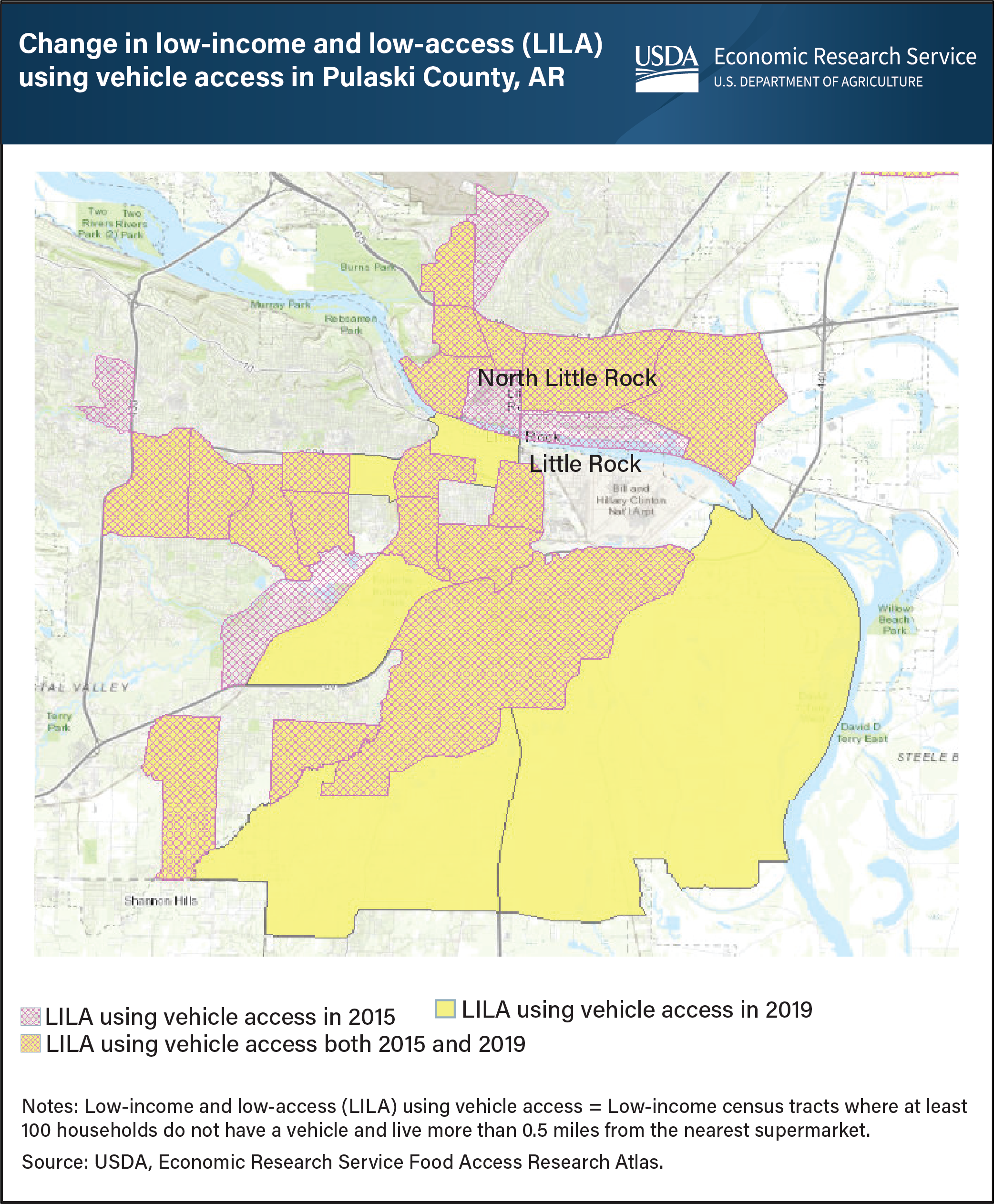
The USDA, Economic Research Service’s (ERS) Food Access Research Atlas provides a map of neighborhoods with limited access to nutritious, affordable food for the entire United States. Limited access to high-quality, low-cost food may impede some consumers from achieving a healthy diet. The updated Atlas allows users to map low-income and low-supermarket access census tracts for 2019 and compare the results with those for 2015. Individuals can choose to display one or several of the measures of low-supermarket access that are based on residents’ distances from the nearest supermarket (more than 0.5 or 1 mile in urban areas or more than 10 or 20 miles in rural areas) and whether a substantial number of households have access to a vehicle. One measure considers a tract to be low-income and low-access (LILA) if it is low-income and contains a substantial number of vehicle-less households that live more than 0.5 miles from the nearest supermarket. Using this measure, the number of low-income and low-access census tracts in Pulaski County, Arkansas, for example, rose 4 percent from 2015 to 2019. Twenty-three percent of Pulaski County households lived in these tracts in 2019, including 6 percent who lived more than 0.5 miles from a supermarket and did not have a vehicle. This map was created using ERS’s Food Access Research Atlas, updated April 27, 2021.