
Double-cropped acreage varies by region
- by Economic Research Service
- 5/29/2014
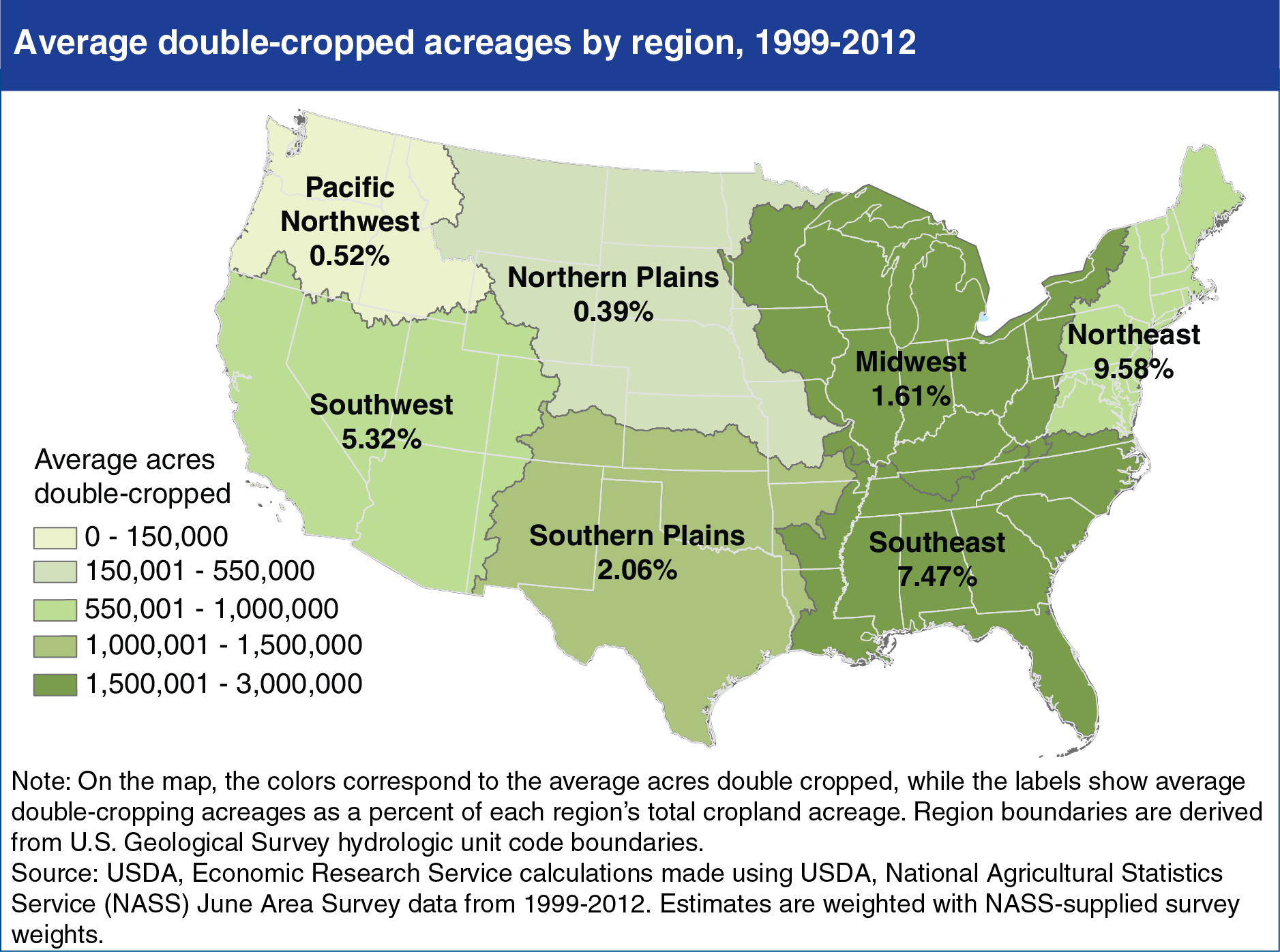
Over the last decade, growing demand for agricultural commodities—for both food and fuel—has increased the incentives for farm operators to raise production. Double cropping, the harvest of two crops from the same field in a given year, has drawn interest as a method to intensify production without expanding acreage. In the U.S., the prevalence of double cropping varies by region. The variation across regions reflects farmers’ response to local conditions such as weather, climate (particularly growing season length), policy differences, and market incentives. The Southeast, Midwest, and Southern Plains regions lead the country in total double-cropped acreage. About one-third of the total double-cropped acreage over 1999-2012 was in the Southeast (2.7 million acres on average), and slightly more than one-fifth was in the Midwest (1.8 million acres on average). However, relative to each region’s total cropland acreage, the Northeast, Southeast, and Southwest all have larger shares of cropland used in double cropping than other regions. The Northeast had the largest share of double-cropped acreage (nearly 10 percent, on average) of the region’s total cropland, and the Northern Plains had the smallest (less than 0.5 percent on average). This chart is found in the ERS report, Multi-Cropping Practices: Recent Trends in Double-Cropping, EIB-125, May 2014.