
Simulating the interactions between climate adaptation and conservation program design
- by Economic Research Service
- 5/20/2013
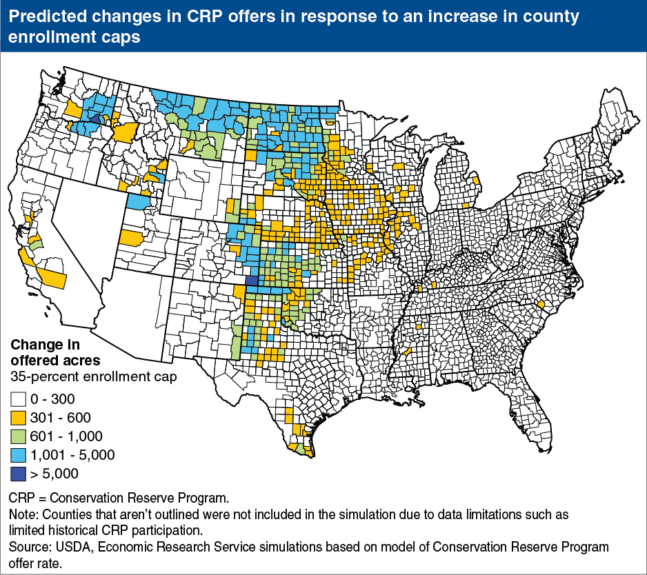
Farmers can adapt to their local climate in many ways, including through participation in USDA programs. In regions of the country that face higher levels of drought risk, farmers are more likely to offer eligible land for enrollment in the Conservation Reserve Program (CRP). As a consequence, CRP is both more competitive in these regions and drought-prone counties are more likely to face a binding CRP acreage enrollment cap. When counties are near their enrollment cap, farms are less likely to offer eligible land for CRP because those offers are less likely to be accepted for enrollment. In simulations of offer rates based on observed historical data, a national increase in the county CRP acreage enrollment cap to 35 percent of cropland in each county (from the current level of 25 percent), results in more offers from eligible farmers in drought prone regions of the Great Plains and the Intermountain West. This map is found in the ERS report, The Role of Conservation Programs in Drought Risk Adaptation, ERR-148, April 2013.