
Uphill climb: The share of rural residents living in low-income areas increases with road ruggedness
- by Elizabeth A. Dobis and John Cromartie
- 11/1/2023
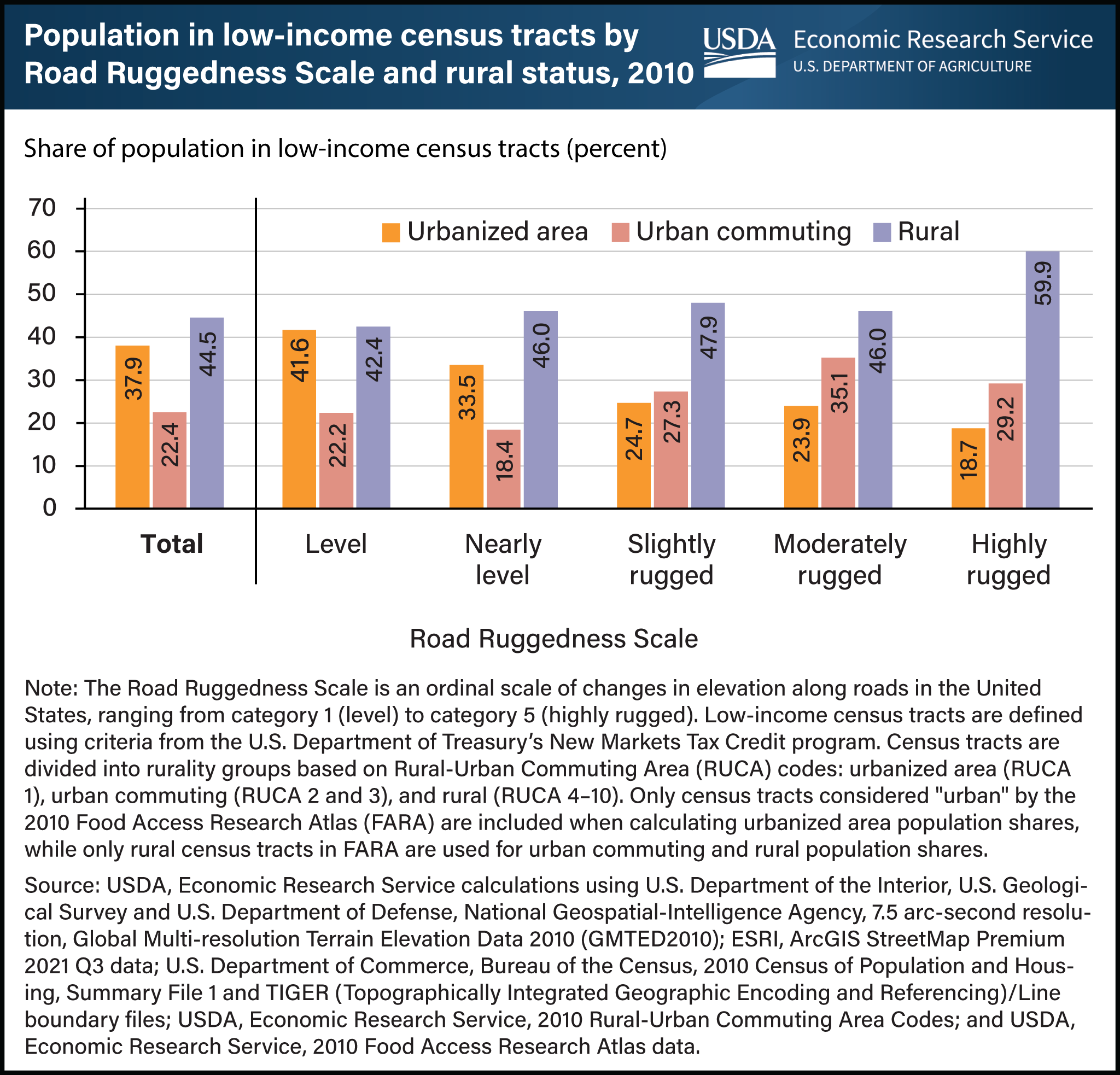
In 2010, a higher share of rural residents lived in low-income census tracts, especially in places characterized by rugged terrain. Researchers with USDA, Economic Research Service (ERS) classified census tracts (the small geographic areas used to collect population data) by the change in elevation along their roads to create the new Road Ruggedness Scale. Using this scale in conjunction with data on income and how rural a place is, they found that as ruggedness increased, the share of rural residents living in low-income census tracts increased. In contrast, the share of residents in low-income census tracts in urbanized areas decreased as ruggedness increased. Nearly 60 percent of residents in highly rugged rural locations lived in low-income census tracts in 2010, compared with 42 to 48 percent of rural residents in less rugged census tracts. However, fewer than 20 percent of residents in highly rugged, urbanized areas lived in low-income census tracts, compared with nearly 42 percent of urbanized area residents in level census tracts. In urban commuting locations, the share of the population living in low-income census tracts generally increased with ruggedness, but with more variation in the trend. This chart appears in the ERS report Characterizing Rugged Terrain in the United States published in August 2023 and uses data available in ERS’s Ruggedness Scale data product.