
Aerial imagery remains mostly grounded on U.S. farms
- by Jonathan McFadden and Eric Njuki
- 8/24/2023
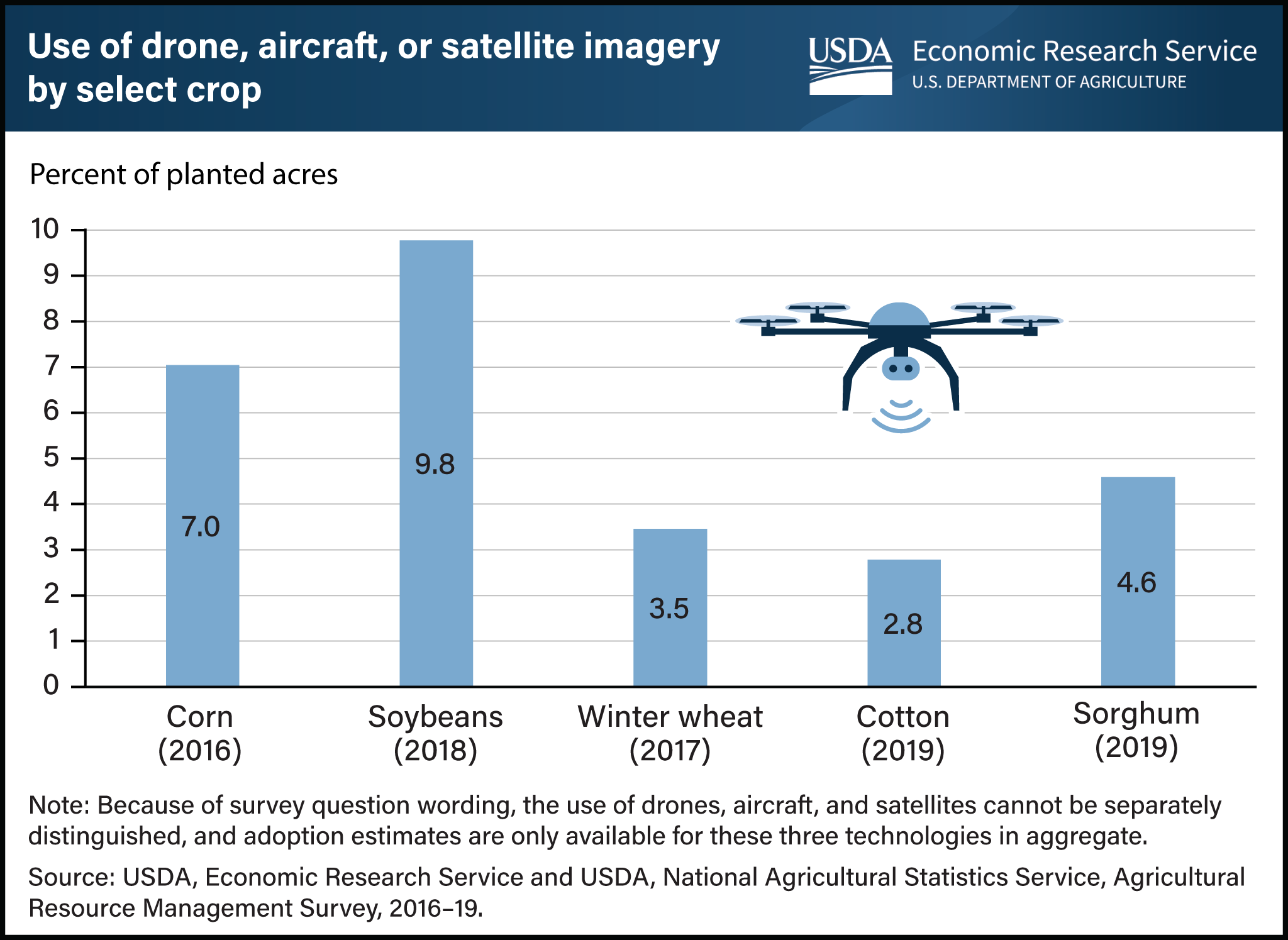
Use of aerial imagery provided by aircraft, drones, and satellites remains limited on U.S. farms. USDA has tracked adoption of many agricultural production technologies through its annual Agricultural Resource Management Survey (ARMS) of U.S. farms. Farmers using drones and aircraft can survey large stretches of farm and ranch land. Aerial imagery helps identify land features or vegetation patterns that are more easily visible from above and thus aids in crop mapping, livestock monitoring, land surveying, crop spraying, and crop dusting. According to the most recent data for various row crops, aerial imagery was used on 7.0 percent of acres planted to corn in 2016 and 9.8 percent for soybeans in 2018. The adoption rate on winter wheat-planted acreage in 2017 was 3.5 percent, with comparable adoption in 2019 on cotton acres (2.8 percent) and sorghum (4.6 percent). For context, in 2016, these adoption rates were lower than those of related technologies like yield maps (43.7 percent) and soil maps (21.5 percent), which provide visualizations of how yields and soil properties vary within and across fields. The ongoing digitalization of U.S. agriculture presents considerable opportunities for improvement in farmers’ productivity, environmental footprint, and risk management. This chart appears in the USDA, Economic Research Service report Precision Agriculture in the Digital Era: Recent Adoption on U.S. Farms, published in February 2023.