
ERS develops scale to help explore effects of rugged roads on U.S. residents
- by Elizabeth A. Dobis and John Cromartie
- 8/2/2023
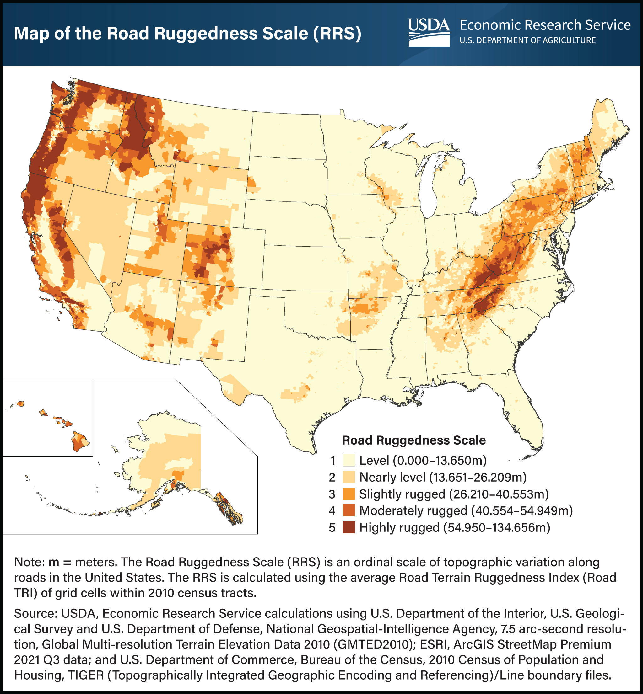
USDA, Economic Research Service (ERS) has developed the Road Ruggedness Scale (RRS) to aid in understanding the unique role of rugged terrain as both a benefit and hindrance to the well-being of communities and their residents. The RRS has five categories based on changes in elevation along roads within census tracts (the small geographic areas used to collect population data). The census tracts are classified as: 1–level, 2–nearly level, 3–slightly rugged, 4–moderately rugged, or 5–highly rugged. Most census tracts have very little topographic variation, with 65.6 percent classified as level in the RRS. The next largest category is nearly level, with 22.4 percent of census tracts. The remaining 12.0 percent of census tracts are classified as slightly to highly rugged, and only 4.4 percent are classified as moderately or highly rugged. The RRS helps to identify landscape characteristics that may present an impediment to settlement and travel, such as the Appalachian and Rocky Mountains, the Pacific Mountain System, the Ozark and Ouachita Mountains, and the Black Hills. These geologic features can make it difficult for people living in rugged areas to access services. They can also attract tourists and prospective residents who prefer rugged terrain or are interested in outdoor activities. To our knowledge, the RRS is the first roads-only, detailed ruggedness measure with full nationwide coverage for the United States. It has the potential to contribute to research on links between the geography and well-being of individuals, especially those living in rural areas, as well as to other research and policy applications. This chart appears in the ERS report Characterizing Rugged Terrain in the United States, published in August 2023. The Road Ruggedness Scale data product published in September 2023.