
Wind energy development located mostly on cropland, pasture
- by Karen Maguire, Sophia Tanner and Justin B. Winikoff
- 8/5/2024
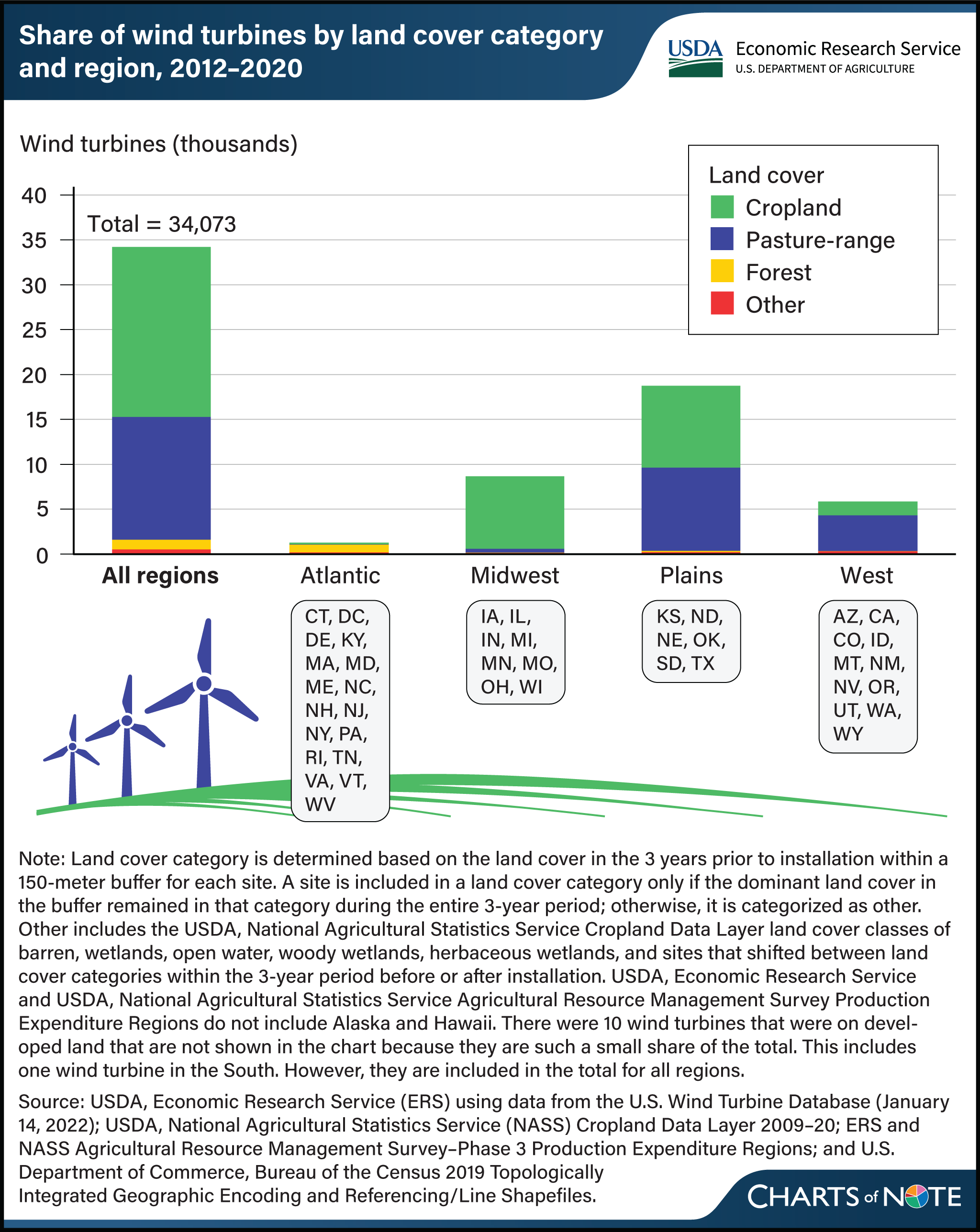
Researchers with USDA, Economic Research Service (ERS) studied the land cover associated with 34,073 wind turbines installed on rural land between 2012 and 2020. Nationwide, they found that around 96 percent of wind turbines were installed on cropland (56 percent) or pasture-rangeland (40 percent). In the Midwest, 94 percent of wind turbines were installed on cropland. In the Plains, sites were almost equally split between cropland (49 percent) and pasture-rangeland (50 percent). In the West, 69 percent were located on pasture-rangeland and 27 percent on cropland. The Atlantic was the only region with a large share on nonagricultural land; 75 percent were located on forest land. However, only a small share of turbines was in the Atlantic (3 percent), and fewer than 1,000 turbines were on land categorized as forest. Read about the expansion of wind and solar in rural areas of the contiguous United States, the regional distribution of renewable energy development, and the land cover change associated with development in the ERS report Utility-Scale Solar and Wind Development in Rural Areas: Land Cover Change (2009–20), released in April 2024.