
Cropland harvested declined by 3 million acres, largely due to uptick in crop failure
- by Daniel Bigelow
- 2/1/2018
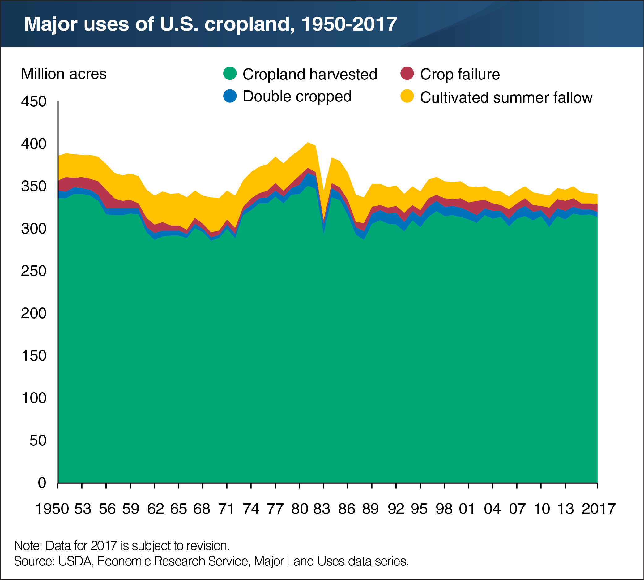
The ERS Major Land Uses (MLU) series defines cropland used for crops as being comprised of three components: cropland harvested, crop failure, and cultivated summer fallow. Collectively, these components represent the land devoted to crop production in a given year. In 2017, cropland harvested declined to 314 million acres, 3 million acres less than the previous year’s area—the lowest recorded harvested cropland area since 2013 (311 million acres). A crop failure increase of 2 million acres largely contributed to this decline. The area that was double cropped, land from which two or more crops were harvested, held constant over the previous year at 6 million acres. Similarly, land used for cultivated summer fallow, which primarily occurs as part of wheat rotations in the semi-arid West, maintained its 2016 level of 12 million acres—the lowest recorded estimate since the start of the MLU series. The larger historical fluctuations in cropland used for crops are primarily attributable to Federal cropland acreage reduction programs, which affect the amount of idled cropland (cropland not directly involved in crop production in a given year). This chart uses historical data from the ERS Major Land Uses series, recently updated to include new 2017 estimates and revised 2016 estimates.