
ERS's Food Access Research Atlas reveals areas in the United States where people live far from supermarkets
- by Michele Ver Ploeg
- 10/20/2015
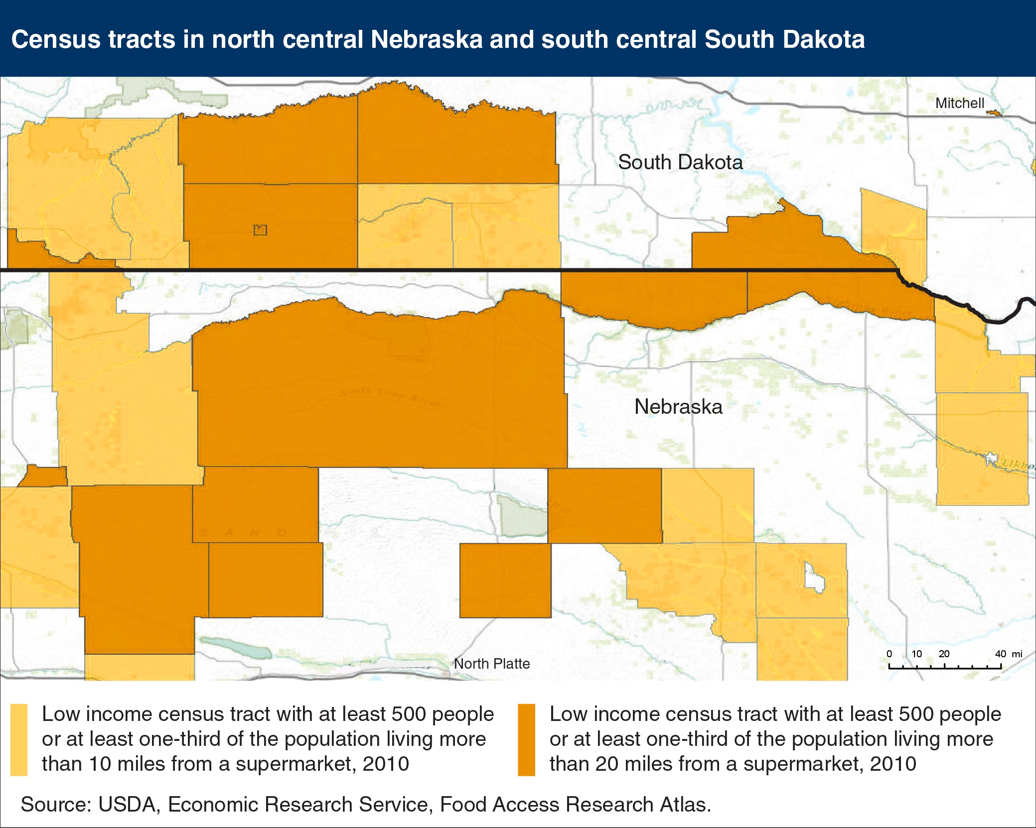
Limited access to sources of healthy and affordable food may make it harder for some Americans to eat a healthy diet. Distance from one’s home to a retailer offering a wide variety of fresh, canned, and frozen foods is an often-used measure of food access. USDA’s Food Access Research Atlas maps several measures of food access, including low-income census tracts where a large number or share of the residents live 10 miles or more from a supermarket or large grocery store. In the example map of north central Nebraska and south central South Dakota, low-income tracts shaded light orange contained at least 500 people or at least one-third of the population who lived more than 10 miles from the nearest supermarket in 2010. Low-income tracts shaded dark orange contained a significant number or share of residents who lived more than 20 miles from a supermarket. Nationally, about 2.1 million people lived in low-income census tracts and were at least 10 miles from the nearest supermarket in 2010 and over 300,000 lived more than 20 miles from the nearest supermarket. This map is from the Food Access Research Atlas on the ERS website.