
ERS releases the 2013 Urban Influence Codes
- by Economic Research Service
- 6/14/2013
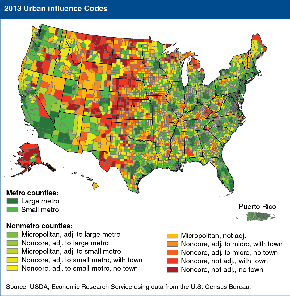
The Urban Influence (UI) codes classify all U.S. counties, as well as “municipios” in Puerto Rico, by size of metropolitan area, adjacency to a metropolitan or micropolitan area, and size of the largest town. These codes are updated every 10 years after the release of new decennial census data and updated metropolitan and micropolitan areas by the Office of Management and Budget (OMB). The latest UI codes were released in May 2013. Compared with 2003, in 2013 there are an additional 78 metropolitan counties, 114 counties moved from nonmetropolitan to metropolitan, and 36 counties changed from metropolitan to nonmetropolitan for a total of 1,167. The number of nonmetro counties fell from 2,053 to 1,976 between 2003 and 2013. The UI codes enable users to analyze the diversity of rural counties by their size, and access to larger economies that serve as centers of trade, finance, information, and communications. The codes provide a more finely articulated measure of rural and take advantage of OMB’s metropolitan, micropolitan, and noncore classification system. ERS uses the codes extensively in its research on rural labor, poverty, population change, employment, and unemployment. This map is found on the ERS website as part of the Urban Influence Codes data product, updated May 2013.