
For most U.S. counties, a small proportion of children face low food access
- Contact: Website Administrator
- 3/15/2013
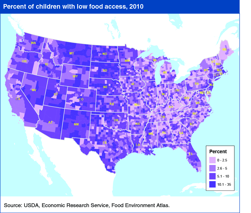
Ready access to healthy, affordable foods can help parents and children make better food choices and can play a role in children’s nutrition and health. One commonly used measure of access to nutritious, affordable foods (food access) is distance to the nearest supermarket, supercenter, or large grocery store. In ERS’s online mapping tool—the Food Environment Atlas—low food access is defined as living more than 1 mile from one of these types of food retailers. In 89 percent of U.S. counties, 10 percent or less of children (birth to age 17) had low food access in 2010. While using 1 mile to delineate low access provides a uniform national measure, it also may overestimate access problems in rural areas, where people are more likely to have access to vehicles, making traveling farther to supermarkets easier. This map and others showing measures of food access can be found in ERS's Food Environment Atlas.