
Map of the Area Ruggedness Scale (ARS)
- by John Cromartie and Elizabeth A. Dobis
- 1/16/2024
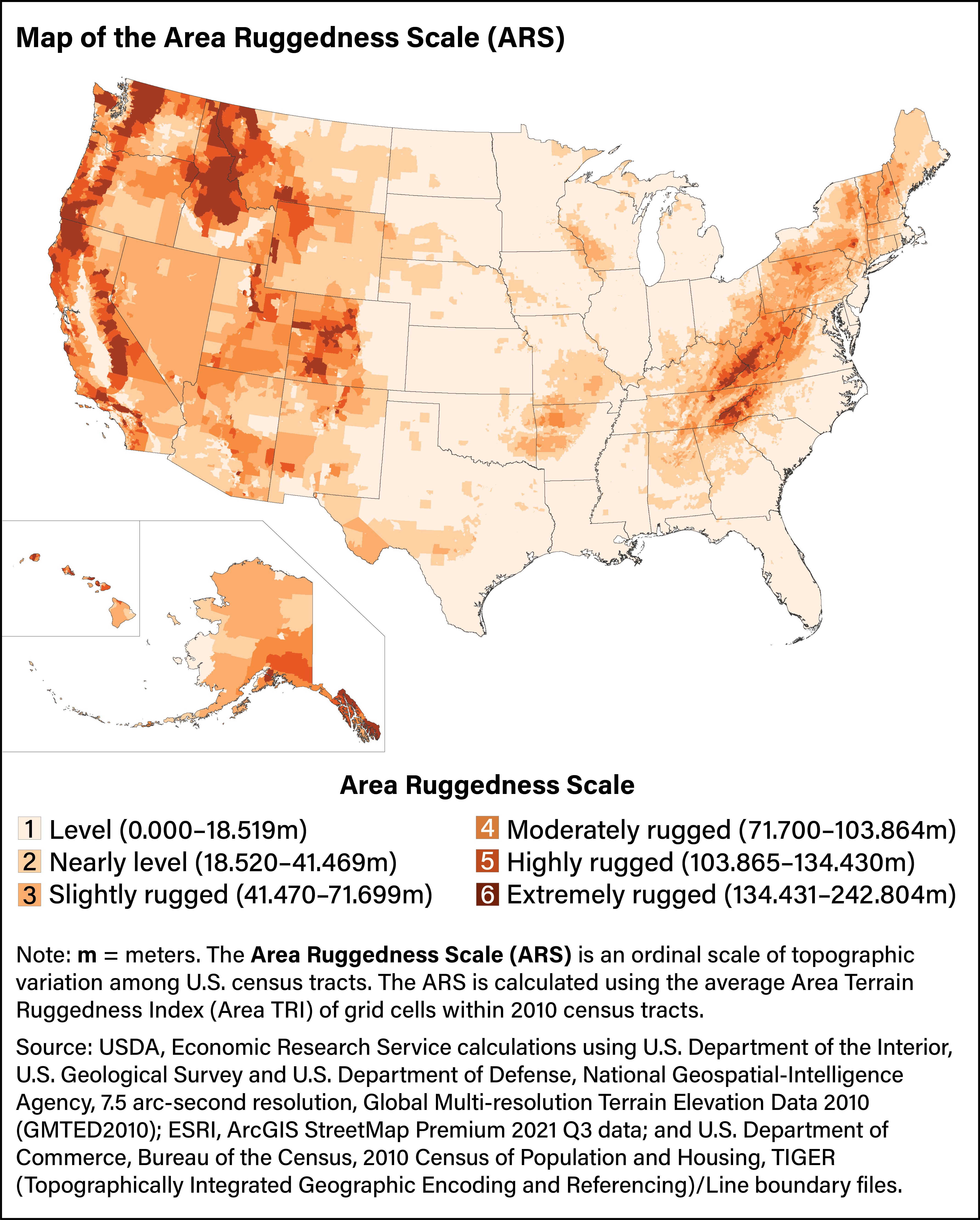
The intersection of rugged terrain and economic activity remains understudied, so USDA, Economic Research Service researchers developed two classifications of U.S. census tracts: the six-level Area Ruggedness Scale and the five-level Road Ruggedness Scale.